Self Storage Site Selection Study
Site Selection/GIS Analysis
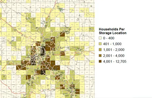
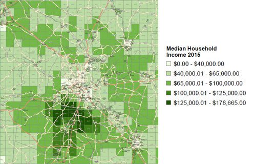
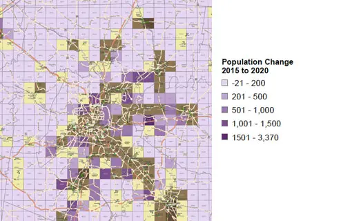
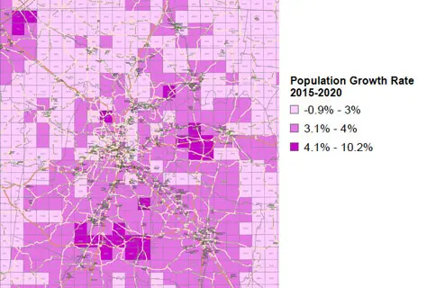
We use Geographic Information System (GIS) technology to divide large geographic data and information into representative micro markets, as seen in each image below. GIS analysis is a visibility tool that enables the self-storage developer to research and understand important market fundamentals related to self-storage site selection and find the best possible measurement of the geography. In each image below, the darker colors generally represent the terrain, price, and location demographics most favorable for self-storage.
If you want to learn more about self-storage and how our GIS software's spatial analysis can benefit your property or next investment project, read up on our feasibility study and site evaluation services. This will help you determine whether your desired location for self-storage is up to the task.

As the image above shows, our site selection study data and research find that the top areas for the construction of self-storage units are where there are more homes per site selection location.

When it comes to investing in self-storage, our GIS tool readings find that the community that will benefit the most from self-storage is those who make above a six-figure threshold. Those who have a higher budget for quality self-storage units will be able to better make use of a storage facility.

The above image illustrates the increase in population from 2015 to 2020. Our GIS analysis indicates that the population of consumers has changed in favor of self-storage over five years and has continued to see growth over the last four years.

The statistic of potential self-storage users has grown exponentially from 2015 to 2020, and current evaluation has seen that number grow even further. Self-storage locations decided by GIS analytics tools are a reliable investment for your real estate or company.
FREQUENTLY ASKED QUESTIONS
Geographic information systems are software and other computer tools used to store, analyze, interpret, and read geography data. GIS helps evaluate geographic data and information that can then be used for site selection studies and self-storage site selection.
